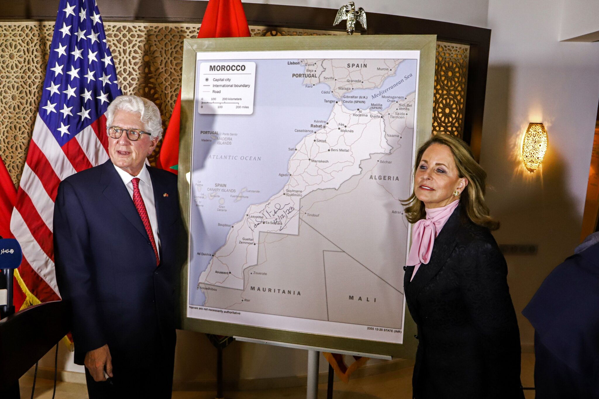
The US announced its adoption of a new map of Morocco on Saturday that includes the disputed Western Sahara, after recognising the Kingdom’s sovereignty over the territory.
Ambassador David Fisher made the announcement on the fringe of the signing ceremony of the new map at the US Embassy in Rabat.
“The new map of Morocco was approved after US President Donald Trump announced, on Thursday, the recognition of the sovereignty of the Kingdom over the Sahara region,” said Fisher. Washington recognised Western Sahara as disputed territory before Trump’s decision, which was made in return for Morocco normalising relations with Israel.
Rabat insists on its right to Western Sahara, for which it proposes autonomous and extended rule under its sovereignty. The Polisario Front, meanwhile, calls for a referendum to decide the fate of the region. It is supported in this by Algeria, which hosts refugees from the contested area.
Since 1975 and the end of the Spanish occupation, Western Sahara has been disputed between Morocco and the Polisario Front. The dispute developed into an armed conflict that lasted until 1991, and ended with the signing of a ceasefire agreement that declared Guerguerat region to be a demilitarised zone.
At the end of last month, the Polisario Front announced an end to the ceasefire agreement, following a military operation launched by the Moroccan army to open the Guerguerat passage, which was closed by Polisario loyalists on 21 October.
 Eurasia Press & News

